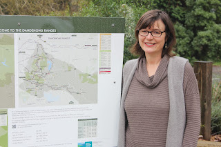
The town signs have been erected in Lilydale, Healesville, Coldstream, Yarra Glen, Warburton, Seville, Woori Yallock, Yarra Junction, Belgrave, Olinda, Mt Evelyn, Kallista, Montrose, Monbulk and Mt Dandenong.
Council partnered with Yarra Ranges Regional Marketing to create the signs.
The maps and signs have a consistent look and feel to help people navigate their way through the Yarra Ranges.
The maps include walking trails, picnic grounds, gardens, play spaces, aquatic centres, petrol stations as well as a list of tourism businesses.
The feedback from local business has been positive with business groups reporting an increase
The maps are available to businesses associated with Yarra Ranges Regional Marketing to use for their websites, map productions and apps.
For more information, contact Economic Development at Council on 1300 368 333.
Monday, 16 September 2013
Find Your Way - New Tourist Maps
Subscribe to:
Post Comments (Atom)


 Copyright ©
0 comments:
Post a Comment